Paddling Lower Alabama
Sunday, August 06, 2006
8/6/2006: Cane Bayou

Destination: Cane Bayou
Launch: Highway 190; Fountainebleau State Park; Mandeville, LA
Distance: 6 miles
Pace: Leisurely
Time: 3 hours
Weather: Mostly sunny and humid with the average morning temperature in the mid-80s. The bayou had no significant current or wind factors.
I want to give a shout out and a thank you to Pat and the rest of the folks from the Bayou Haystackers that helped me research the area. A couple weeks ago, I began planning a visit to the New Orleans north shore to see my buddy from college. Matt had never been kayaking before and he asked me to bring my boats. At first, I really wanted to dig into the waters of a traditional Louisiana swamp (15 - 20 miles or so), but since it was Matt's first kayaking experience ever and my first paddling experience in Louisiana we decided to check out Cane Bayou at Fountainebleau State Park, not far from his house. It was a very easy paddle and we had alot of fun, expecially exploring some of the side channels into the surrounding marsh.

Top Left: We were on the water by 7:30am. The morning temperature was nice and pleasant as was the scenery.
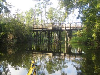
Top Right: This is one of the Tammany Trace bridges. The Tammany Trace is an unused railroad corridor that stretches a scenic 31-miles from Slidell to Covington, Louisiana. The trail is used by pedestrians, bicyclists, rollerbladers, and joggers along the northshore of Lake Pontchartrain across from New Orleans in St. Tammany Parish.


Top Left: We only saw one powerboat the entire time. This is what's left of their wake. The only other traffic included another kayak, a john boat with a trolling motor and a man and his little girl in their homemade pirogue.
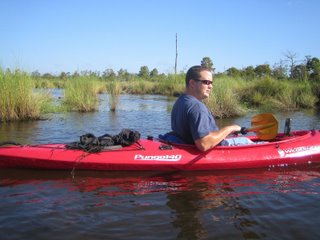
Top Right: Matt, a local firefighter and lady's man in his fire-engine-red Pungo 140, strikes the stud/GQ pose for the camera.


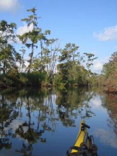
Top Left: There's some really nice scenery along the banks of Cane Bayou and no current to fight.
Top Right: The only thing that would have made this trip nicer is about 10 more miles of bayou.

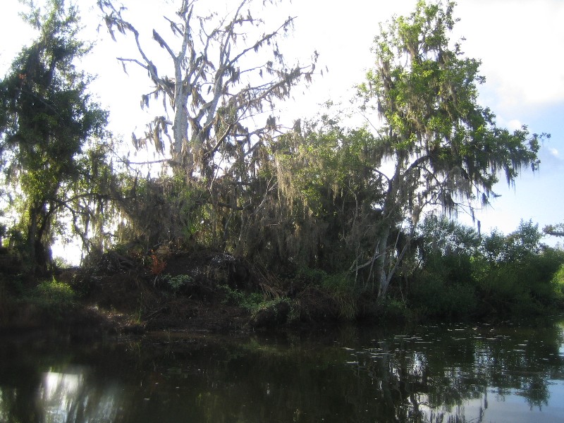
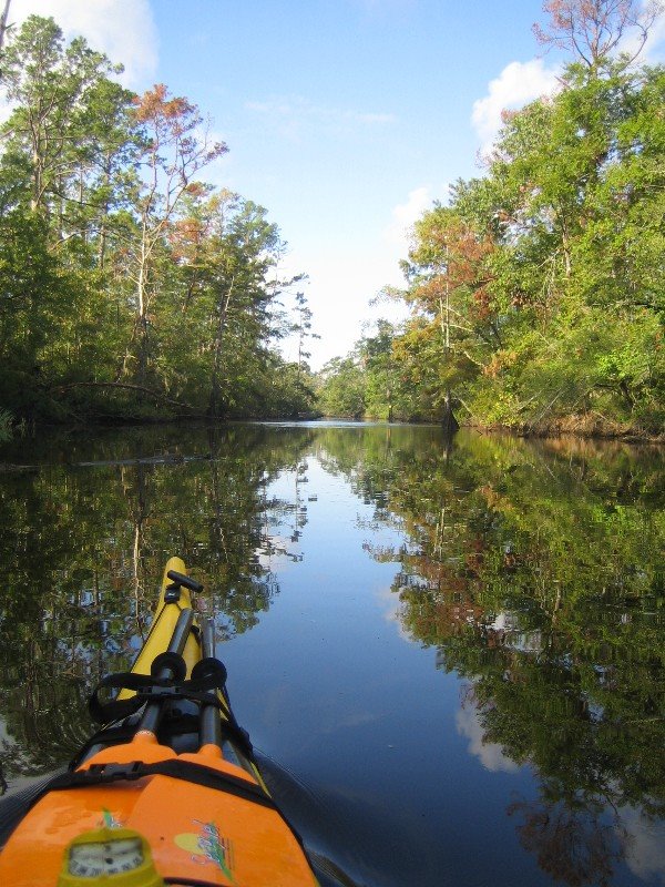
Top Left: The cedar and cypress here created a nice Louisiana swamp theme as we paddled toward Lake Ponchartrain.
Top Right: A white heron waits for us to move along so he can get on with his fishing.

Above: This is my favorite shot of the bayou scenery that we took in on our way to the lake.


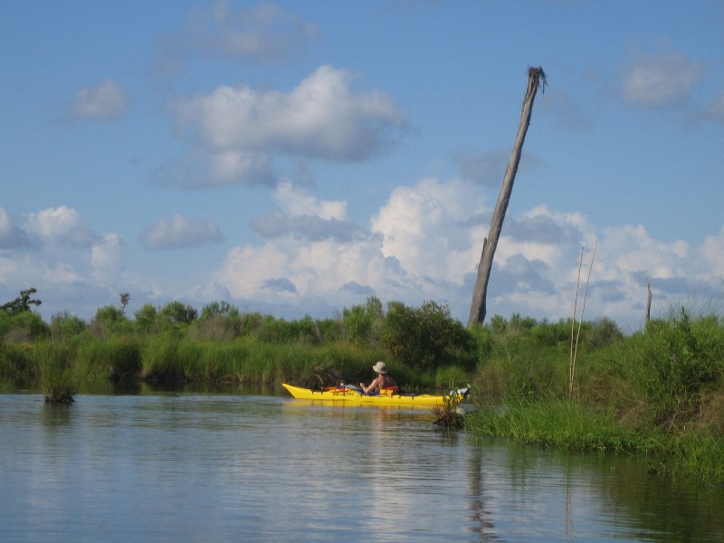
Top Left: The lake was calmer than I expected. We had a light southerly wind but nothing to create alot of chop. This is a shot of Matt trying to spot some tailing reds.
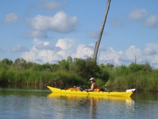
Top Right: Matt actually checked the depth here. It was perfect for a first-time kayaker, only about 3 feet. If you fall out you can stand up.
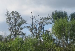
Top Left: I took this photo after we started exploring the smaller channels that fed into Cane Bayou. This osprey, wings spread wide open, is getting ready to take flight.
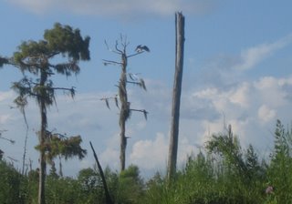
Top Right: We didn't see ospreys until we left the main bayou. In the middle of this picture, there are 2 more in the top of a dead tree.

Top Left: As we followed a small tributary into Big Branch Marsh National Wildlife Refuge we saw a change of scenery to the surrounding hardwoods of the upper bayou. Although it was more difficult to find shade, we found the morning sun was very tolerable and the scenery was great.
Top Right: Matt took this shot of me checking to see if anyone was home in this osprey nest.
Top Left: He tried to convince me to climb the tree to get a better look but I elected to steer clear of the barbed talons. I might have tried it if I were hopped up on magic mushrooms and Jagermeister but it just wasn't worth the $5.
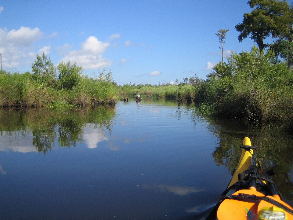
Top Right: The channel started to tighen up on us as we pushed further into the marsh until we made it through to this shallow basin.


Top Left: After forcing our way through walls of grass and a channel that could fit only one kayak at a time, we thought this basin would be a rest from the trail blazing. Had the water here been more than 6-8 inches deep that might have been true.
Top Right: It's amazing what marsh gases are released by a kayak paddle in the mud. The odor was so pungent, Matt and I competed for lead so we could stay ahead of the smell. The guy in back (me in this photo) was simply screwed. Seriously, it smelled like foot and ass.


Top Left: This was the my last photo of the marsh as we made our way back to Cane Bayou.
Top Right: Back on the bayou.


Top Left: I took this photo as Matt rammed me from the side. He blamed it on his lack of experience but I know better, jackass.
Top Right: I thought this was a really cool shot with the tree completely wrapped in spanish moss.


Top Left: I won't pretend to understand why this turtle was sunning like this but he had his back legs fully extended as if he were airing out his taint or something.
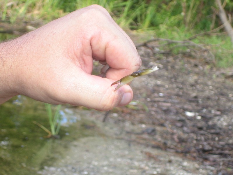
Top Right: Matt somehow ended up with a small crab in his boat. We didn't have a clue how he got in there but he locked on to Matt's thumb and shedded his claw when Matt tried to turn him loose.


Top Left: We continued north of Highway 190, where I took this photo. This heron was not at all camera shy.
Top Right: The upper bayou scenery wasn't as pretty as toward the lake but we did see our first cajun waterfall.

Above: This was the end of the line thanks to Hurricane Katrina. Athough this was a shorter distance paddle than I usually prefer, I really enjoyed it. Matt also had a great time and now wants me to keep my eyes open for a good deal on a used kayak. ¶ 10:02 AM 0 comments
Destination: Cane Bayou
Launch: Highway 190; Fountainebleau State Park; Mandeville, LA
Distance: 6 miles
Pace: Leisurely
Time: 3 hours
Weather: Mostly sunny and humid with the average morning temperature in the mid-80s. The bayou had no significant current or wind factors.
I want to give a shout out and a thank you to Pat and the rest of the folks from the Bayou Haystackers that helped me research the area. A couple weeks ago, I began planning a visit to the New Orleans north shore to see my buddy from college. Matt had never been kayaking before and he asked me to bring my boats. At first, I really wanted to dig into the waters of a traditional Louisiana swamp (15 - 20 miles or so), but since it was Matt's first kayaking experience ever and my first paddling experience in Louisiana we decided to check out Cane Bayou at Fountainebleau State Park, not far from his house. It was a very easy paddle and we had alot of fun, expecially exploring some of the side channels into the surrounding marsh.


Top Left: We were on the water by 7:30am. The morning temperature was nice and pleasant as was the scenery.
Top Right: This is one of the Tammany Trace bridges. The Tammany Trace is an unused railroad corridor that stretches a scenic 31-miles from Slidell to Covington, Louisiana. The trail is used by pedestrians, bicyclists, rollerbladers, and joggers along the northshore of Lake Pontchartrain across from New Orleans in St. Tammany Parish.

Top Left: We only saw one powerboat the entire time. This is what's left of their wake. The only other traffic included another kayak, a john boat with a trolling motor and a man and his little girl in their homemade pirogue.
Top Right: Matt, a local firefighter and lady's man in his fire-engine-red Pungo 140, strikes the stud/GQ pose for the camera.
Top Left: There's some really nice scenery along the banks of Cane Bayou and no current to fight.
Top Right: The only thing that would have made this trip nicer is about 10 more miles of bayou.


Top Left: The cedar and cypress here created a nice Louisiana swamp theme as we paddled toward Lake Ponchartrain.
Top Right: A white heron waits for us to move along so he can get on with his fishing.
Above: This is my favorite shot of the bayou scenery that we took in on our way to the lake.


Top Left: The lake was calmer than I expected. We had a light southerly wind but nothing to create alot of chop. This is a shot of Matt trying to spot some tailing reds.
Top Right: Matt actually checked the depth here. It was perfect for a first-time kayaker, only about 3 feet. If you fall out you can stand up.


Top Left: I took this photo after we started exploring the smaller channels that fed into Cane Bayou. This osprey, wings spread wide open, is getting ready to take flight.
Top Right: We didn't see ospreys until we left the main bayou. In the middle of this picture, there are 2 more in the top of a dead tree.

Top Left: As we followed a small tributary into Big Branch Marsh National Wildlife Refuge we saw a change of scenery to the surrounding hardwoods of the upper bayou. Although it was more difficult to find shade, we found the morning sun was very tolerable and the scenery was great.
Top Right: Matt took this shot of me checking to see if anyone was home in this osprey nest.


Top Left: He tried to convince me to climb the tree to get a better look but I elected to steer clear of the barbed talons. I might have tried it if I were hopped up on magic mushrooms and Jagermeister but it just wasn't worth the $5.
Top Right: The channel started to tighen up on us as we pushed further into the marsh until we made it through to this shallow basin.


Top Left: After forcing our way through walls of grass and a channel that could fit only one kayak at a time, we thought this basin would be a rest from the trail blazing. Had the water here been more than 6-8 inches deep that might have been true.
Top Right: It's amazing what marsh gases are released by a kayak paddle in the mud. The odor was so pungent, Matt and I competed for lead so we could stay ahead of the smell. The guy in back (me in this photo) was simply screwed. Seriously, it smelled like foot and ass.

Top Left: This was the my last photo of the marsh as we made our way back to Cane Bayou.
Top Right: Back on the bayou.

Top Left: I took this photo as Matt rammed me from the side. He blamed it on his lack of experience but I know better, jackass.
Top Right: I thought this was a really cool shot with the tree completely wrapped in spanish moss.
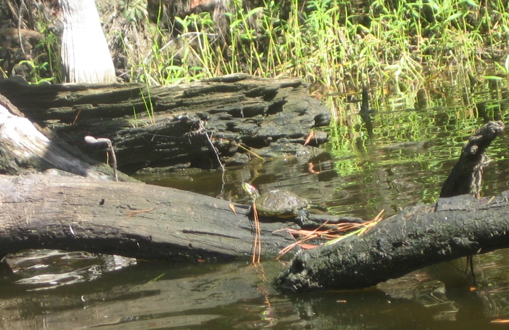
Top Left: I won't pretend to understand why this turtle was sunning like this but he had his back legs fully extended as if he were airing out his taint or something.
Top Right: Matt somehow ended up with a small crab in his boat. We didn't have a clue how he got in there but he locked on to Matt's thumb and shedded his claw when Matt tried to turn him loose.


Top Left: We continued north of Highway 190, where I took this photo. This heron was not at all camera shy.
Top Right: The upper bayou scenery wasn't as pretty as toward the lake but we did see our first cajun waterfall.
Above: This was the end of the line thanks to Hurricane Katrina. Athough this was a shorter distance paddle than I usually prefer, I really enjoyed it. Matt also had a great time and now wants me to keep my eyes open for a good deal on a used kayak. ¶ 10:02 AM 0 comments
Saturday, July 29, 2006
7/29/2006: Chicory Bayou

Destination: Chicory Bayou
Launch: Cloverleaf Landing
Distance: 15.5 miles
Pace: Moderate
Time: 5 hours
Weather: Humid with high temperature of 91 degrees (felt like 100+ at times). Partly cloudy with afternoon thunderstorms. Low tide - 12:54AM (.4), high - 4:20PM (1.2).
With high temperatures being such a PITA during the summer months I had hoped to be on the water before 7:00AM but it wasn't until 8:00AM that I was underway. My first trip to Chuckfee Bay was a few weeks ago with my friend Tony and a couple of guys from the kayak club (Rob and David). Today I would be flying solo so I left a route map with my wife just in case I ran into any trouble that kept me from making in back before dark (it's happened to me before). We had alot of fun exploring some of the creeks and bayous north and east of the bay last time around so today I would be targeting Chicory Bayou on the south side, west of the Raft River entrance, through to Grand Bay and back to Raft River.


Above: Spanish Moss is an epiphyte (air plant), which absorbs nutrients (especially calcium) and water from the air and rainfall. It is not a parasite like mistletoe. It can grow so thickly on tree limbs that it gives a somewhat "gothic" appearance to the landscape, but it rarely harms the trees, except for the extra wind resistance in hurricanes. In the southern U.S., the plant seems to show a distinct preference of growth on southern live oak and swamp cypress, but it can colonize in other tree species such as sweetgum, crape-myrtle, other oaks, or even pine.

Beauty and the beast - Top Left: These flowering plants bring a touch of beauty to the muddy waters of Raft River. Top Right: OHHHH, GOZIRRAHH!!!! I missed capturing my "extreme closeup" opportunity but this was a big fella and I had the misfortune of catching him in a mood. In fact, the thought of taking a photo didn't even cross my mind until I was at a safe distance. I've heard people say that alligators are shy and prefer to avoid humans. WRONG! Alligators are territorial predators and can be aggressive. This guy chased me for about 50 yards (unprovoked) before I made it out of the kill zone. It's true that the typical alligators I see in the swamp prefer to keep their distance but this one was a definite exception (at least 9 feet worth of exception).
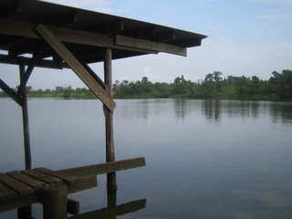

A place to rest my weary back - Top Left: This dock was a great place to get out and stretch for a couple minutes, little did I know this old boat shed would be my safe haven later that day. Top Right: This is the dock view of Raft River to the east, the direction I had just come from.


At Chuckfee Bay - Top Left: Possibly a hurricane victim from many moons ago, these are the skeletal remains of an old wooden river barge. Top Right: This fishing camp's dock looks to be the victim of one of our more recent storms from last season. Although the cabin looks like it's in good shape, the dock is still under construction.

Chicory Bayou - Top Left: Old Glory marks the entrance to Chicory Bayou and the starting point for my bayou run. Top Right: This was not reassuring to see the channel pretty well choked off but I was far from turning back.


The bayou finally opens up - Top Left: After about 1 mile of paddling Chicory Bayou I leave the last of the gator grass behind me. Top Right: Pushing through the grass I couldn't help but think to myself, "man if something bad happens to me out here I'm gonna be in a tight spot," so it was nice to see a clear waterway ahead as I continued south on the bayou.


Time for a lunch break - Top Left: As the temperature continued to rise I figured it was time to break for lunch. This nice shady cypress would be an ideal place to beat the heat. Top Right: This is a downstream photo from the cypress. At this point I was about half way between Chuckfee and Grand Bays.


This real estate is for the birds - Top Left: I passed a number of these large bird houses on Chicory Bayou. I'm guessing ducks to be the primary residents for these little bayou bungalows. I saw quite a few wood ducks and great blue herons along the bayou but they were all too camera shy for me to get a good photo. Top Right: Waterfront property is great, but no one can beat this view. If you click the photo you should be able to see the osprey's head.
 Above: I saw more alligators on this day than I think I ever have on a day trip. Fortunately not all of them were as bad as Mean Joe Green back on Raft River. Most of them actually kept their distance and submerged as I approached.
 Above: This was the final stretch of the bayou as I approached Grand Bay. This was a great place to paddle since I encountered no powerboats along the bayou but I would not recommend doing it solo unless you leave a detailed route plan with someone.


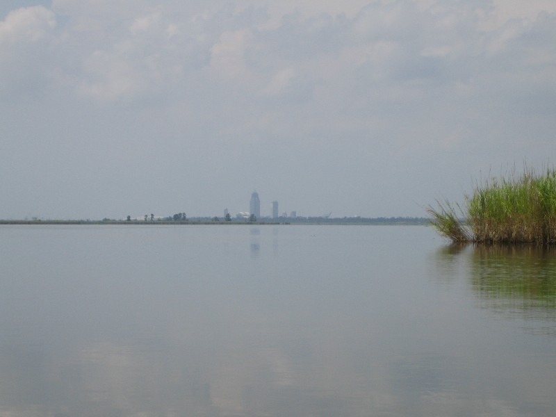
Downtown Mobile from a distance - Top Left: The RSA tower from the northern-most end of Grand Bay. Top Right: As I took this shot of the Cochran-Africatown bridge I began to realize it was getting Africa-hot out here on the bay.


Leaving Grand Bay. Top Left: Not far down a little canal that leads from Grand Bay to Raft River, I found this little bayou BBQ setup. At this point during the day, the air temperature alone seemed hot enough to grill burgers. Top Right: I didn't see any sign of occupants in this nest but there was an opsrey fishing close by.


Back on Raft River - Top Left: Cedar trees lined the banks as I paddled back north toward Chuckfee bay. Top Right: This was a really nice camp that sits on the west bank of the river just before the entrance to Chuckfee Bay. I took a break across the channel for a few minutes in the shade of a large cedar tree.
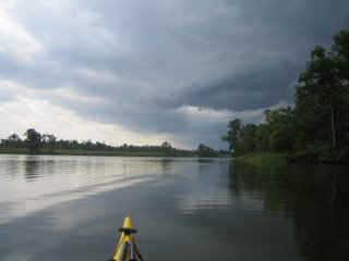

Not a welcome sight. These two photos were taken within 2 minutes of each other. Notice the wind change on the water surface. Top Left: As I rounded the bend of the river back toward the east these thunderclouds moved in. It was nice cover from the sun but I was still at least 5 miles or so from the launch when I began hearing thunder. Top Right: This was my last good photo before the wind picked up and nearly blew the paddle out of my hand. I picked up the pace a bit and made it back the boat shed that I stopped at earlier just in time for the thunderstorm. About 10 minutes after the bottom fell out a couple of guys in a powerboat pulled up also looking for shelter. Fortunately my kayak doesn't require much room so they joined me underneath the boat shed. It's a good thing that they stopped too because after getting turned around in the storm they were headed south when they thought they were going north. These guys were at least 30 miles from their launch (Mt. Vernon) and had no idea where they were so I gave them a map and pointed them back in the right direction. ¶ 2:42 PM 1 comments
Destination: Chicory Bayou
Launch: Cloverleaf Landing
Distance: 15.5 miles
Pace: Moderate
Time: 5 hours
Weather: Humid with high temperature of 91 degrees (felt like 100+ at times). Partly cloudy with afternoon thunderstorms. Low tide - 12:54AM (.4), high - 4:20PM (1.2).
With high temperatures being such a PITA during the summer months I had hoped to be on the water before 7:00AM but it wasn't until 8:00AM that I was underway. My first trip to Chuckfee Bay was a few weeks ago with my friend Tony and a couple of guys from the kayak club (Rob and David). Today I would be flying solo so I left a route map with my wife just in case I ran into any trouble that kept me from making in back before dark (it's happened to me before). We had alot of fun exploring some of the creeks and bayous north and east of the bay last time around so today I would be targeting Chicory Bayou on the south side, west of the Raft River entrance, through to Grand Bay and back to Raft River.


Above: Spanish Moss is an epiphyte (air plant), which absorbs nutrients (especially calcium) and water from the air and rainfall. It is not a parasite like mistletoe. It can grow so thickly on tree limbs that it gives a somewhat "gothic" appearance to the landscape, but it rarely harms the trees, except for the extra wind resistance in hurricanes. In the southern U.S., the plant seems to show a distinct preference of growth on southern live oak and swamp cypress, but it can colonize in other tree species such as sweetgum, crape-myrtle, other oaks, or even pine.


Beauty and the beast - Top Left: These flowering plants bring a touch of beauty to the muddy waters of Raft River. Top Right: OHHHH, GOZIRRAHH!!!! I missed capturing my "extreme closeup" opportunity but this was a big fella and I had the misfortune of catching him in a mood. In fact, the thought of taking a photo didn't even cross my mind until I was at a safe distance. I've heard people say that alligators are shy and prefer to avoid humans. WRONG! Alligators are territorial predators and can be aggressive. This guy chased me for about 50 yards (unprovoked) before I made it out of the kill zone. It's true that the typical alligators I see in the swamp prefer to keep their distance but this one was a definite exception (at least 9 feet worth of exception).


A place to rest my weary back - Top Left: This dock was a great place to get out and stretch for a couple minutes, little did I know this old boat shed would be my safe haven later that day. Top Right: This is the dock view of Raft River to the east, the direction I had just come from.
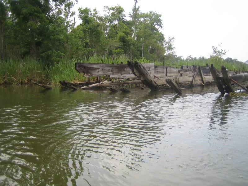

At Chuckfee Bay - Top Left: Possibly a hurricane victim from many moons ago, these are the skeletal remains of an old wooden river barge. Top Right: This fishing camp's dock looks to be the victim of one of our more recent storms from last season. Although the cabin looks like it's in good shape, the dock is still under construction.
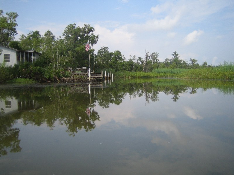

Chicory Bayou - Top Left: Old Glory marks the entrance to Chicory Bayou and the starting point for my bayou run. Top Right: This was not reassuring to see the channel pretty well choked off but I was far from turning back.


The bayou finally opens up - Top Left: After about 1 mile of paddling Chicory Bayou I leave the last of the gator grass behind me. Top Right: Pushing through the grass I couldn't help but think to myself, "man if something bad happens to me out here I'm gonna be in a tight spot," so it was nice to see a clear waterway ahead as I continued south on the bayou.


Time for a lunch break - Top Left: As the temperature continued to rise I figured it was time to break for lunch. This nice shady cypress would be an ideal place to beat the heat. Top Right: This is a downstream photo from the cypress. At this point I was about half way between Chuckfee and Grand Bays.

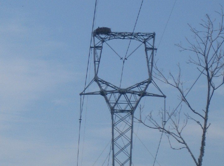
This real estate is for the birds - Top Left: I passed a number of these large bird houses on Chicory Bayou. I'm guessing ducks to be the primary residents for these little bayou bungalows. I saw quite a few wood ducks and great blue herons along the bayou but they were all too camera shy for me to get a good photo. Top Right: Waterfront property is great, but no one can beat this view. If you click the photo you should be able to see the osprey's head.


Downtown Mobile from a distance - Top Left: The RSA tower from the northern-most end of Grand Bay. Top Right: As I took this shot of the Cochran-Africatown bridge I began to realize it was getting Africa-hot out here on the bay.


Leaving Grand Bay. Top Left: Not far down a little canal that leads from Grand Bay to Raft River, I found this little bayou BBQ setup. At this point during the day, the air temperature alone seemed hot enough to grill burgers. Top Right: I didn't see any sign of occupants in this nest but there was an opsrey fishing close by.


Back on Raft River - Top Left: Cedar trees lined the banks as I paddled back north toward Chuckfee bay. Top Right: This was a really nice camp that sits on the west bank of the river just before the entrance to Chuckfee Bay. I took a break across the channel for a few minutes in the shade of a large cedar tree.


Not a welcome sight. These two photos were taken within 2 minutes of each other. Notice the wind change on the water surface. Top Left: As I rounded the bend of the river back toward the east these thunderclouds moved in. It was nice cover from the sun but I was still at least 5 miles or so from the launch when I began hearing thunder. Top Right: This was my last good photo before the wind picked up and nearly blew the paddle out of my hand. I picked up the pace a bit and made it back the boat shed that I stopped at earlier just in time for the thunderstorm. About 10 minutes after the bottom fell out a couple of guys in a powerboat pulled up also looking for shelter. Fortunately my kayak doesn't require much room so they joined me underneath the boat shed. It's a good thing that they stopped too because after getting turned around in the storm they were headed south when they thought they were going north. These guys were at least 30 miles from their launch (Mt. Vernon) and had no idea where they were so I gave them a map and pointed them back in the right direction. ¶ 2:42 PM 1 comments